With the mighty Fraser River to the east and the lush coast of the Pacific Ocean to the west, the Cariboo Chilcotin region of British Columbia holds a fascinating history and endless adventures for those who visit.
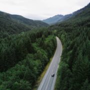
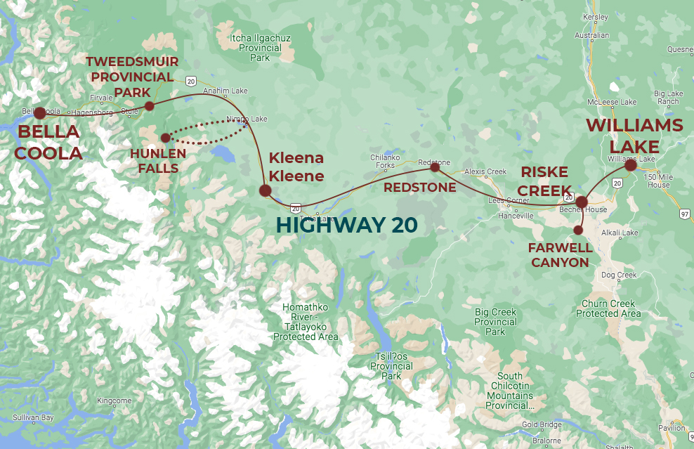
Much of the region’s roads are defined by ancient First Nations trade routes and transportation links from the once-booming Gold Rush era. Highway 20 is the notable connector, bringing visitors on a journey from the dry interior over the high-elevation Chilcotin Plateau and into the Bella Coola valley and Pacific Coast.
While this route can be travelled within a day (it’s about 6 hours from Williams Lake to Bella Coola), our approach is one of slow travel.
A concept growing in popularity, ‘slow travel’ is all about spending more time in each destination, allowing travellers to more deeply connect with the spirit of the place, the wild landscapes, and the eclectic people who call the destination home.
This is how we travel in the West Chilcotin. So get comfortable, grab a tea, and join us for the journey…
Williams Lake & Xatśūll Heritage Village
Our adventure begins in Williams Lake – the central hub of industry in the Cariboo Chilcotin region. Travellers can arrive by car or through daily connecting flights from Vancouver. On the first night we begin to explore what makes this community unique.
Named after Chief William of the Shuswap First Nation, Williams Lake began to flourish during the Gold Rush era of the late 1800s when the region saw tens of thousands of prospectors from Europe, the UK and China arrive to claim their fortune. The town grew in accessibility as the Cariboo Wagon Road and eventually the CN railway were established. While the era of gold mining has since passed, Williams Lake remains the service centre for forestry, mining, logging, ranching, as well as tourism in more recent years. The town is also home to the famous Williams Lake Stampede each July.
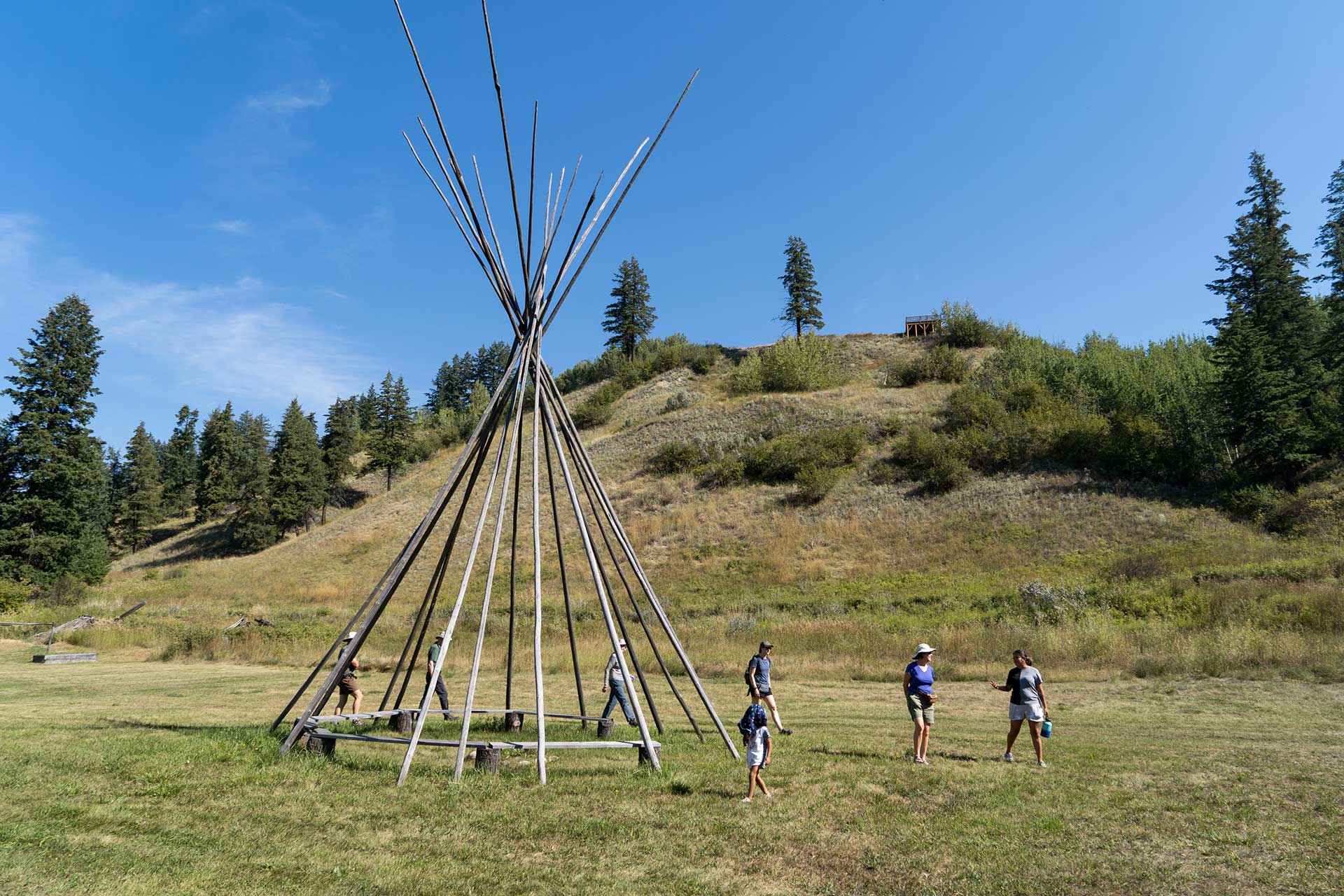
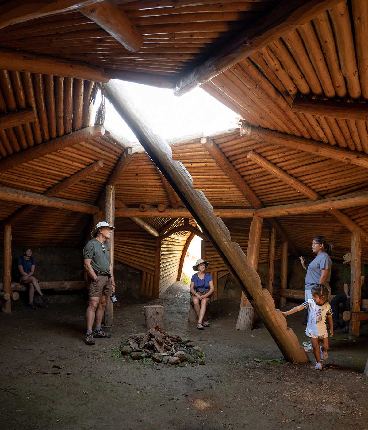
This region is also rich in First Nations history. Just north of Williams Lake is Soda Creek, our next stop on the tour, which is home to the Xatśūll First Nation. Here we are welcomed in to the Xatśūll Heritage Village – an important historic site resting high on the banks of the Fraser River. This location was chosen as it lies at the intersection between three traditional territories of Indigenous people and has been a gathering place for thousands of years.
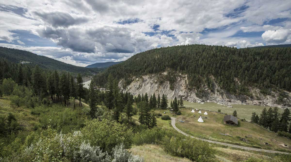
Local members of the Nation guide us through their village and down to the river banks, sharing stories of the Xatśūll’s nomadic culture, traditional shelters, cooking methods like pit cooking, ceremonies and sweat lodges. Built on-site are examples of pit houses to lean-tos, and the site is home to several ancient petroglyphs (rock carvings).
As the storytelling continues, we settle into a home-cooked lunch of stew and bannock, gazing out over the mighty Fraser River and imagining life in the interior.
Chilcotin Plateau & Farwell Canyon
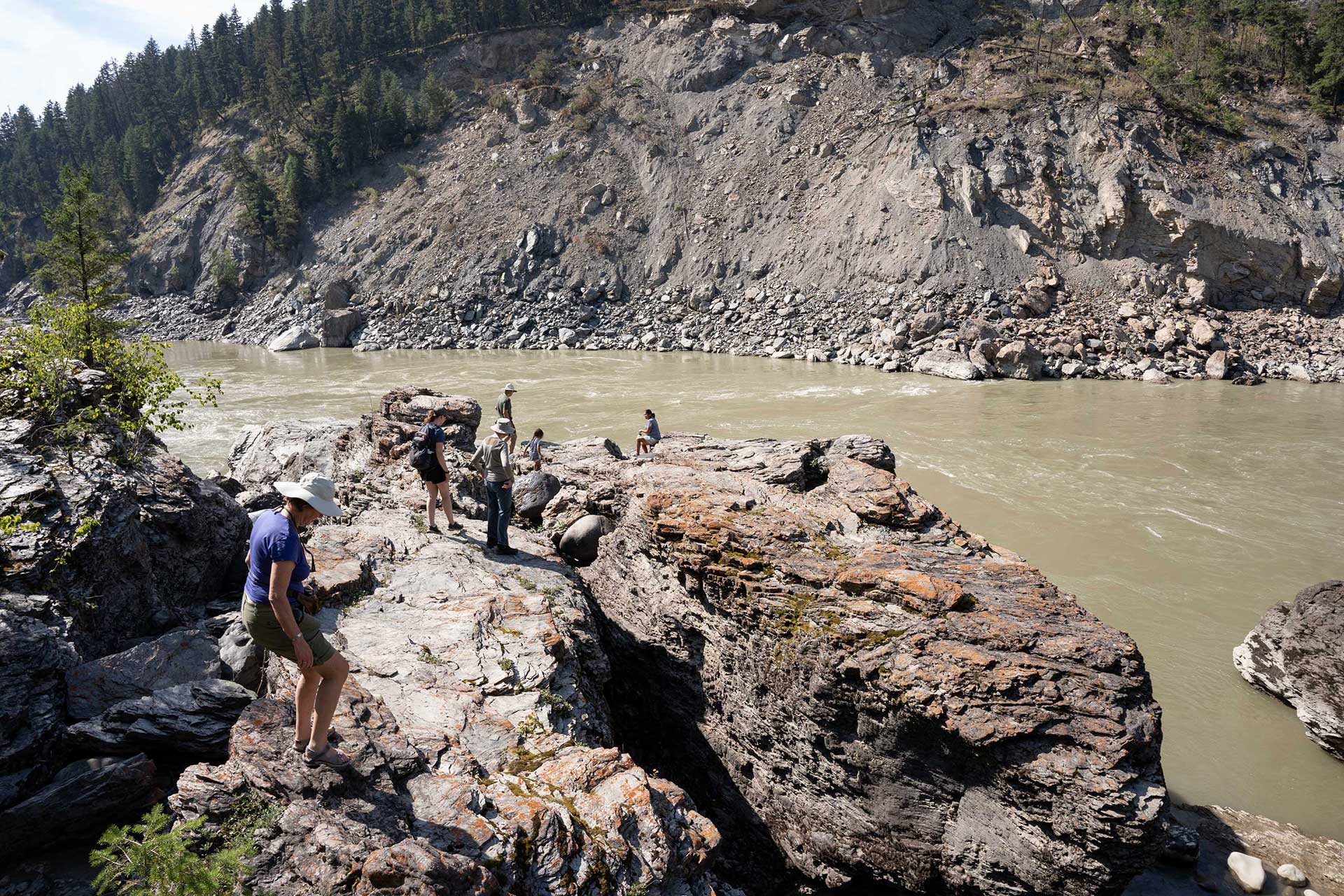
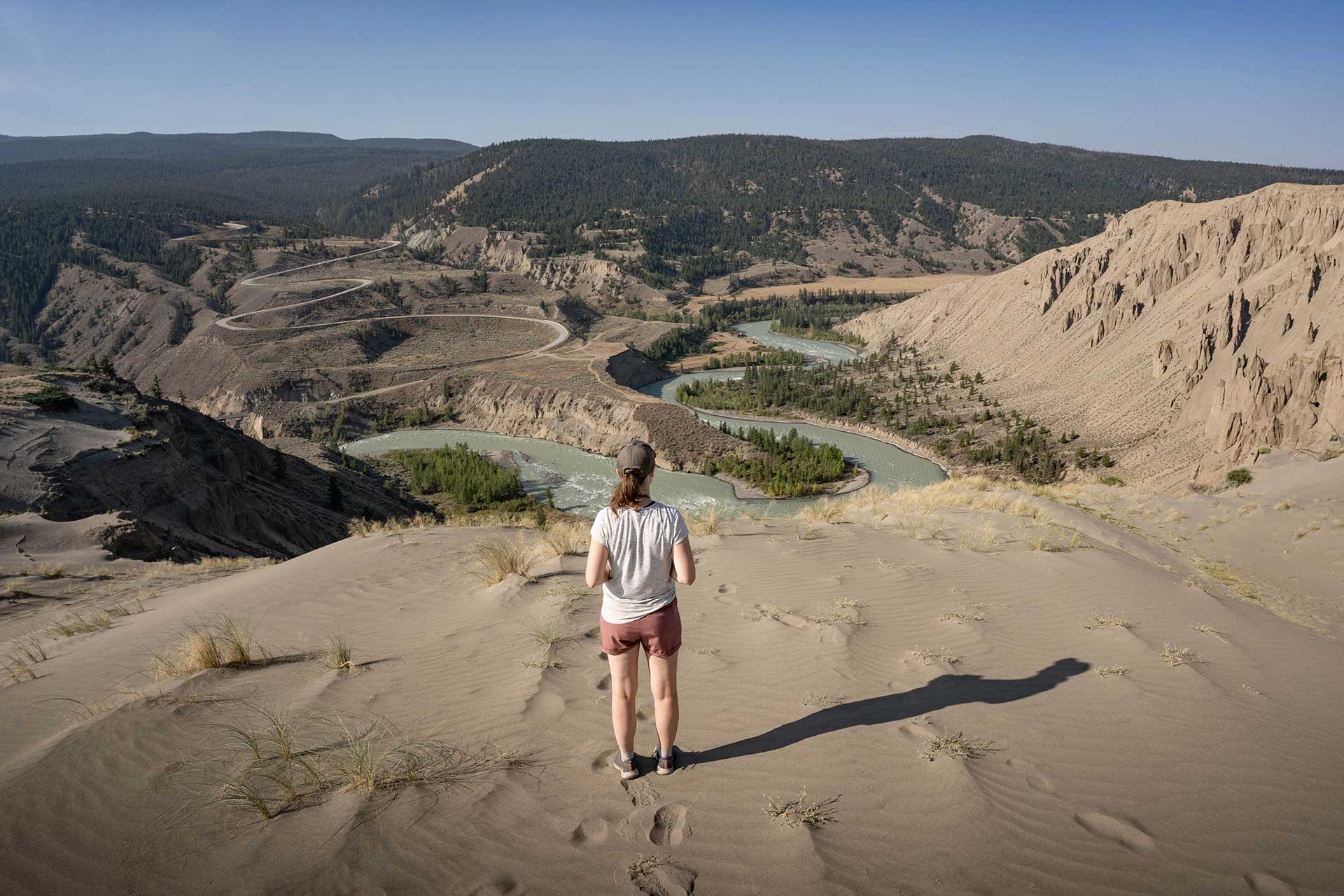
From Williams Lake we join Highway 20 and begin our drive west. The landscapes continue to fascinate as we cross the Fraser River and ascend onto the Chilcotin Plateau. The original inhabitants of this vast and often desolate landscape are the Tsilhqot’in (Chilcotin) First Nation, with territory spanning west from the Fraser River to the Coast Mountain Range. The Chilcotin River follows us for much of our journey on the plateau which, along with other tributaries, has carved deep, scenic canyons.
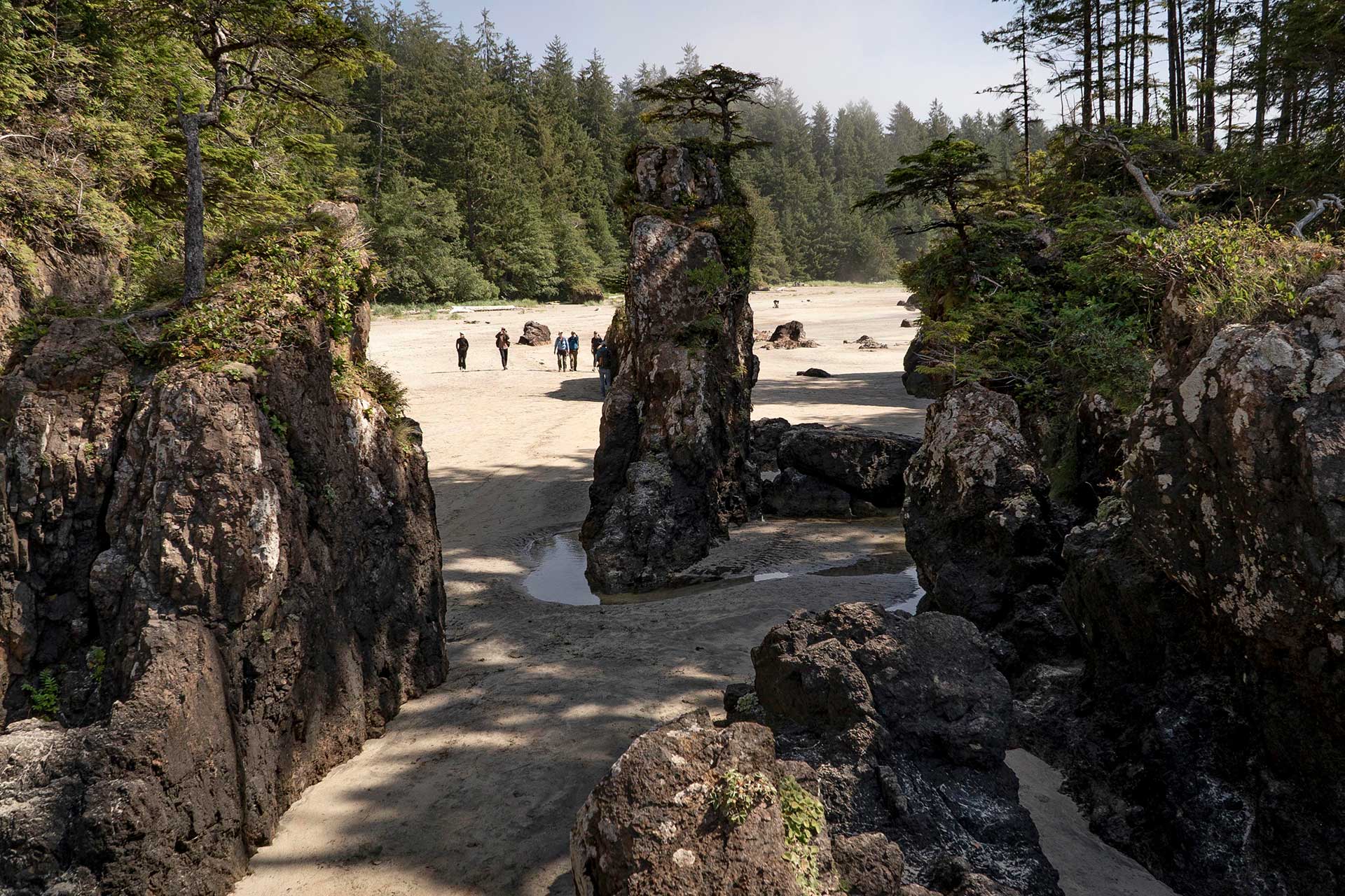
The most iconic of these formations is Farwell Canyon – our next stop. The geology of the canyon is made up of soft sandstone rock, where erosion from the river, rain and wind forces has created steep canyon walls lined with hoodoos, also known as fairy chimneys or tent rocks. The most notable wildlife here is a significant population of over 500 free-roaming California bighorn sheep, often seen wandering the steep ledges above the river.
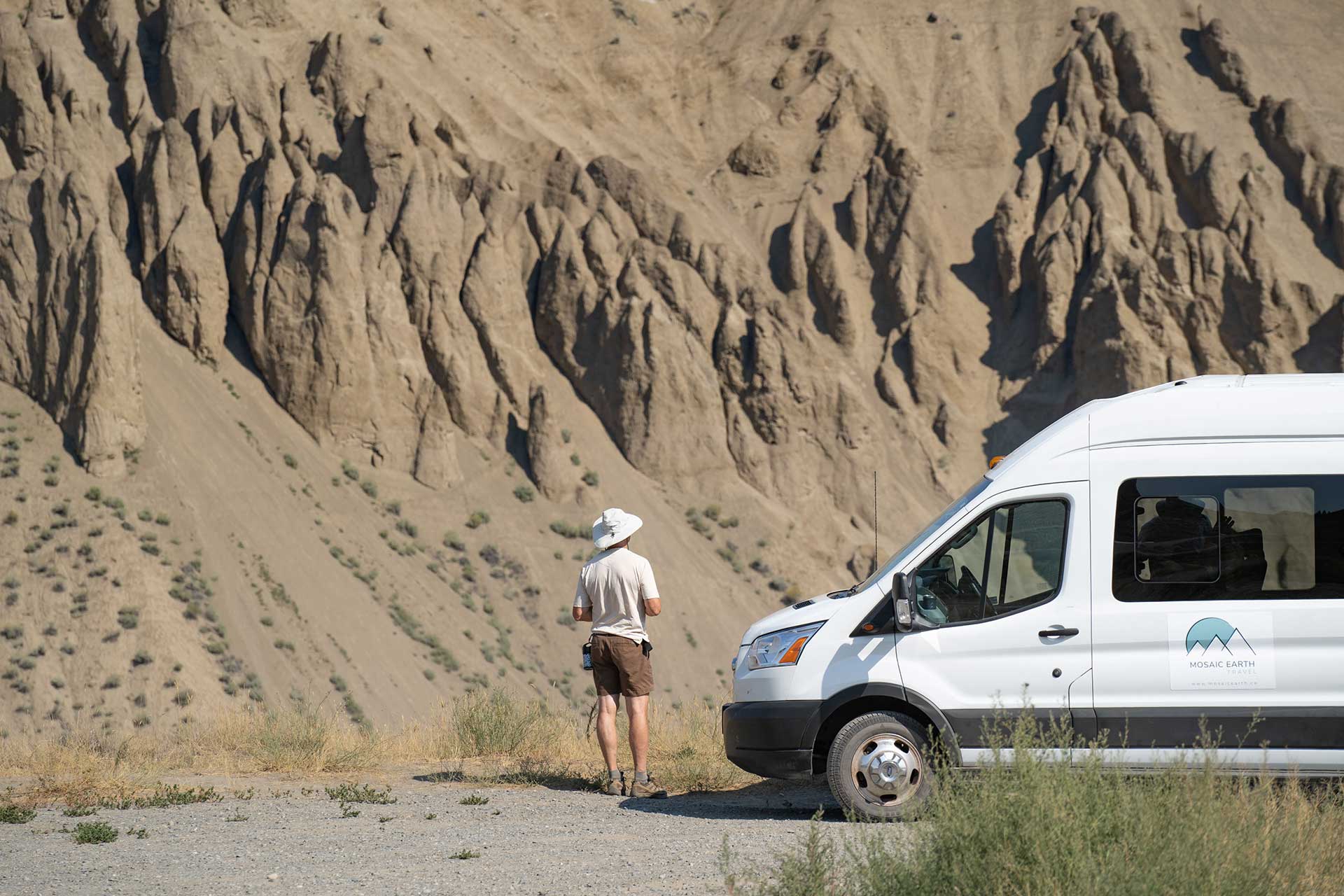
After navigating a series of switchbacks to descend into the canyon, we pull over at the trailhead to begin our exploration on foot. This is a moderate-level hike that weaves through the desert-like landscape, consisting of grasslands, cacti, and sagebrush that cover the hills.
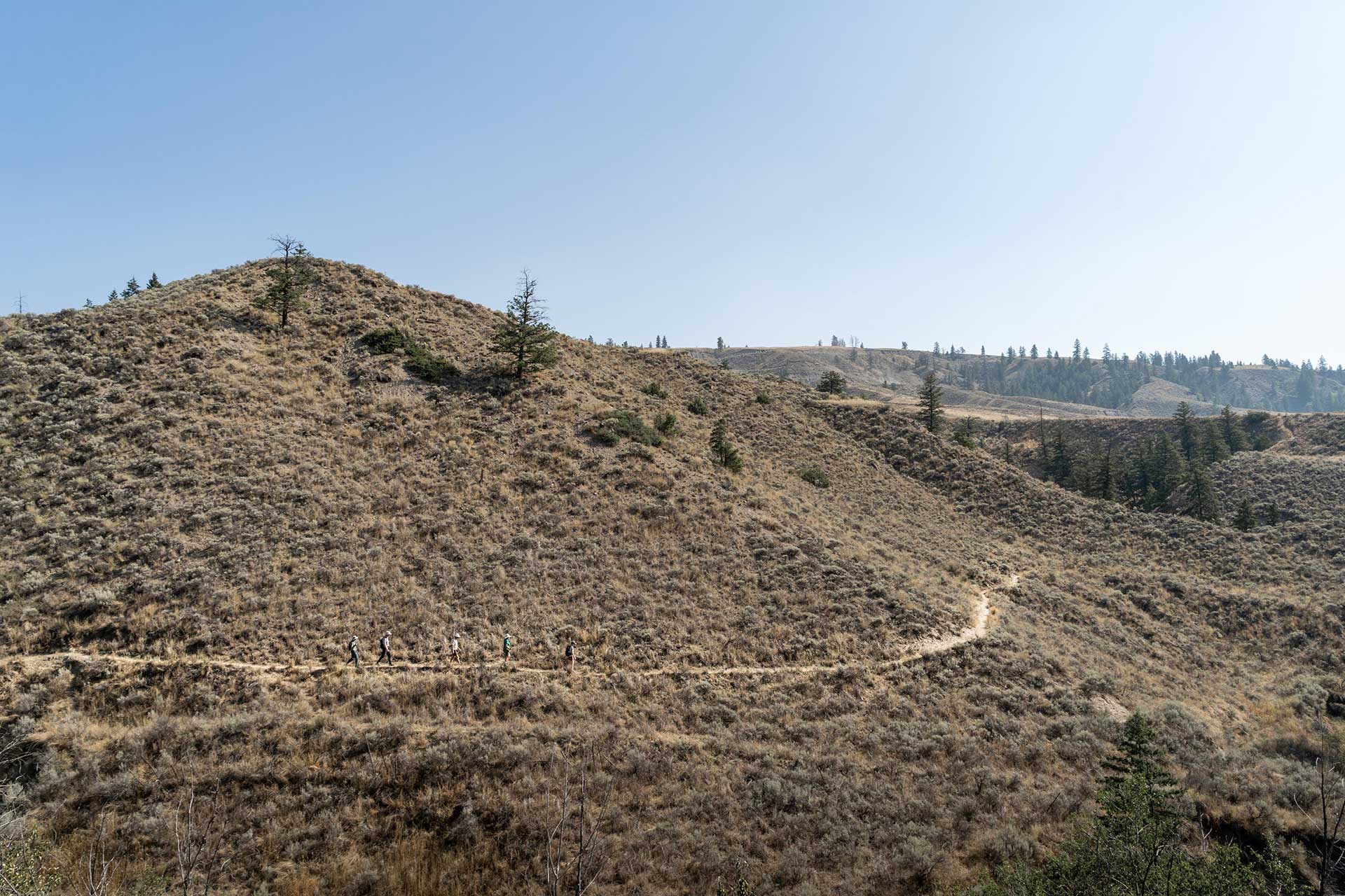
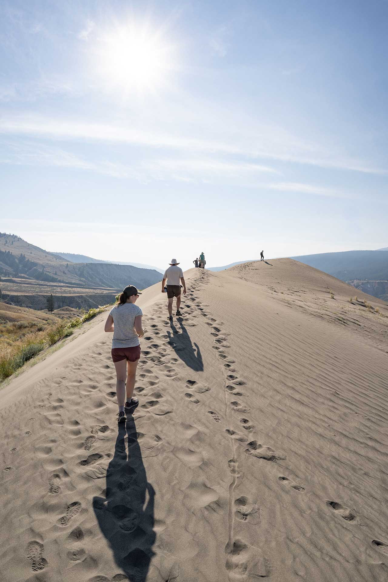
The trail leads us to the top of the canyon where we emerge onto a beautiful white sand dune. This is BC’s largest sand dune, formed from the sandstone and wind forces in the canyon.
This place is like nowhere else in Canada. We take a pause to let it all sink in – the sweeping landscape, the meandering river, and that otherworldly feeling of being on a sand dune, in the desert, in the middle of British Columbia.
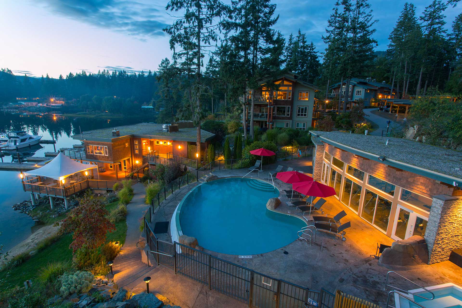
After an inspiring day exploring the unique landscapes of the plateau, we’re welcomed into an historic B&B where our hosts serve up fresh cinnamon buns and charcuterie. Free time can include a visit with the horses, a game of pool, or a refreshing drink on the lawn, followed by a BBQ dinner served on the front porch with sweeping views of the Plateau.
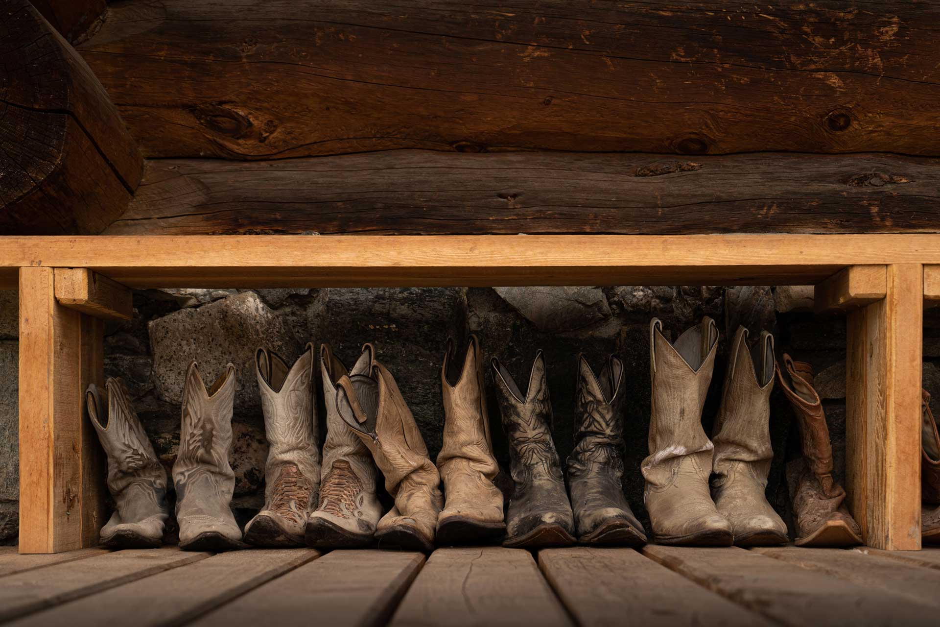
Classic Guest Ranch Experience
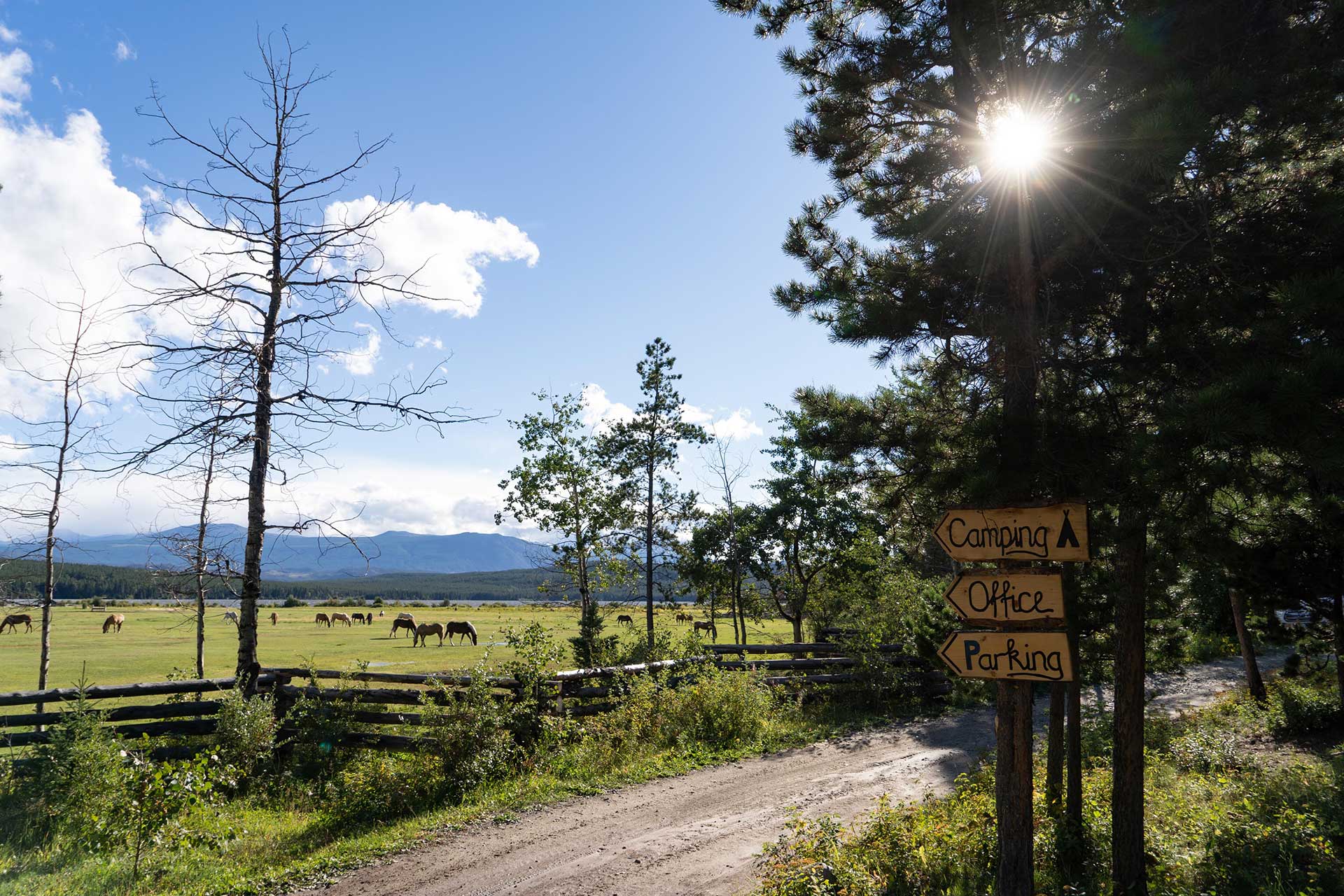
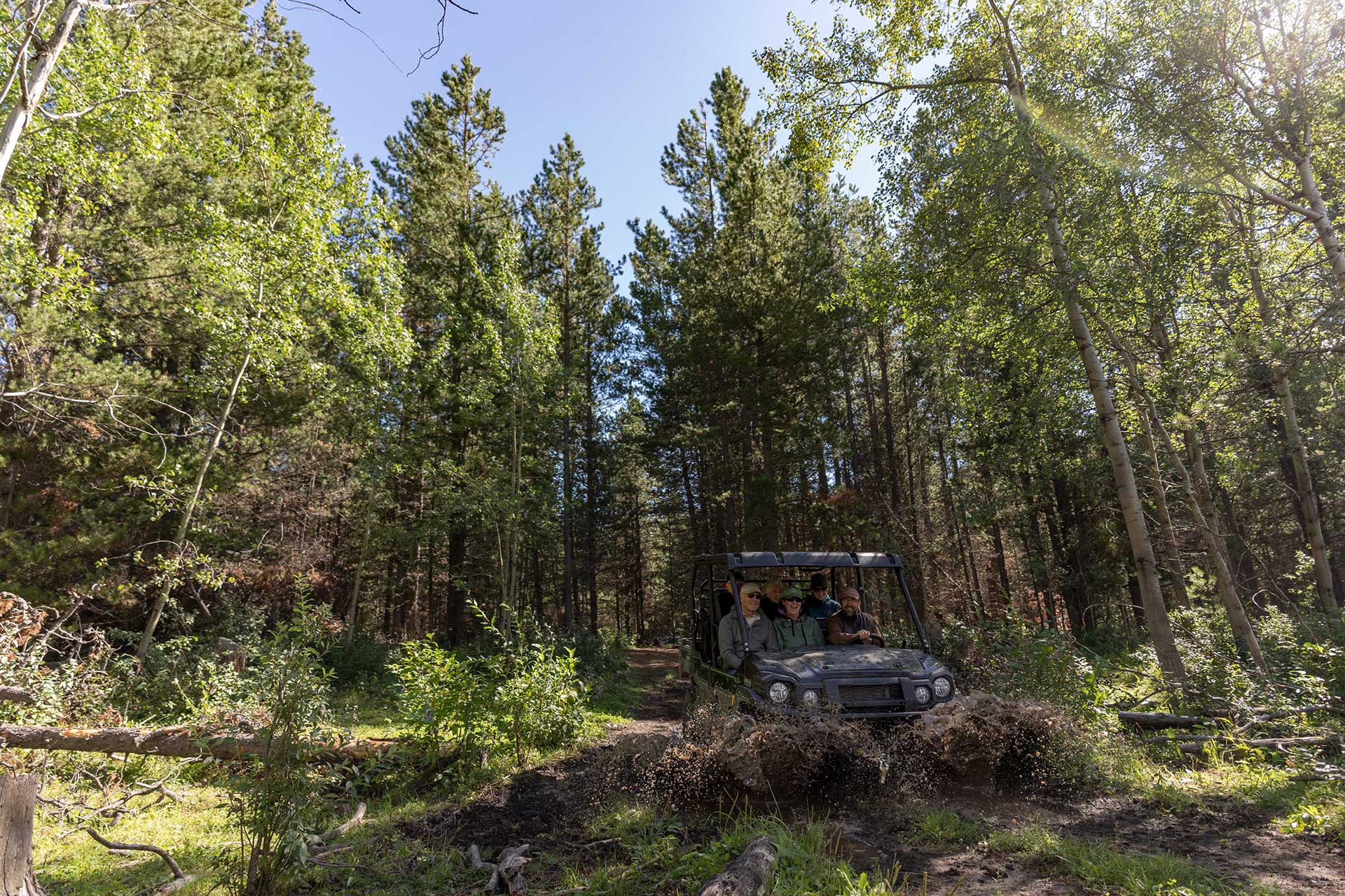
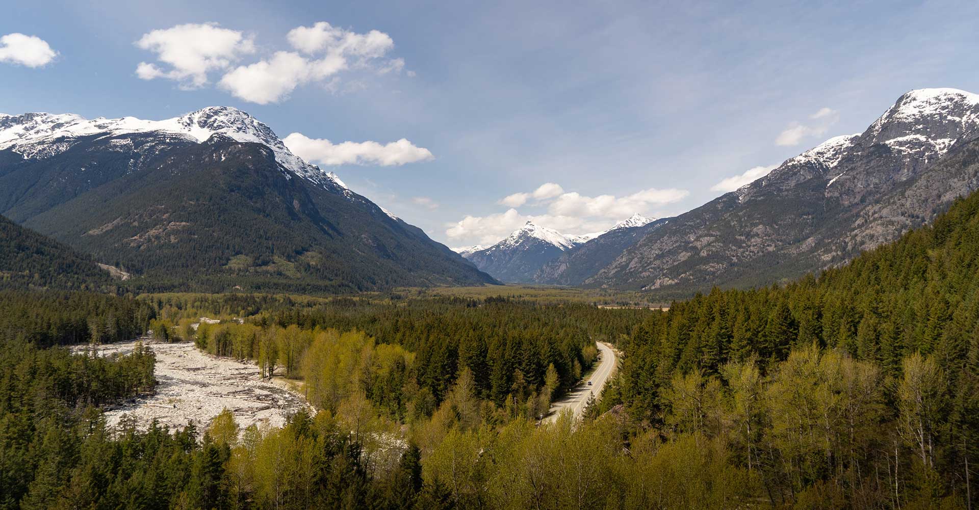
The next day we continue our journey westward, deep into Chilcotin ranch country. In recent decades some of the farms have turned into guest ranches, offering a chance for travellers to step back in time and connect with this part of the region’s history. Our home for the next few days is one such ranch – a classic Canadian experience.
We turn off Highway 20 and take a long winding driveway through the forest before it opens up to expansive views of the horse fields, a large freshwater lake, and the jagged mountain peaks in the distance.
Our hosts, the owners of the ranch, are ready to greet us at the main lodge where we enjoy afternoon tea and cake before getting acquainted with the property.
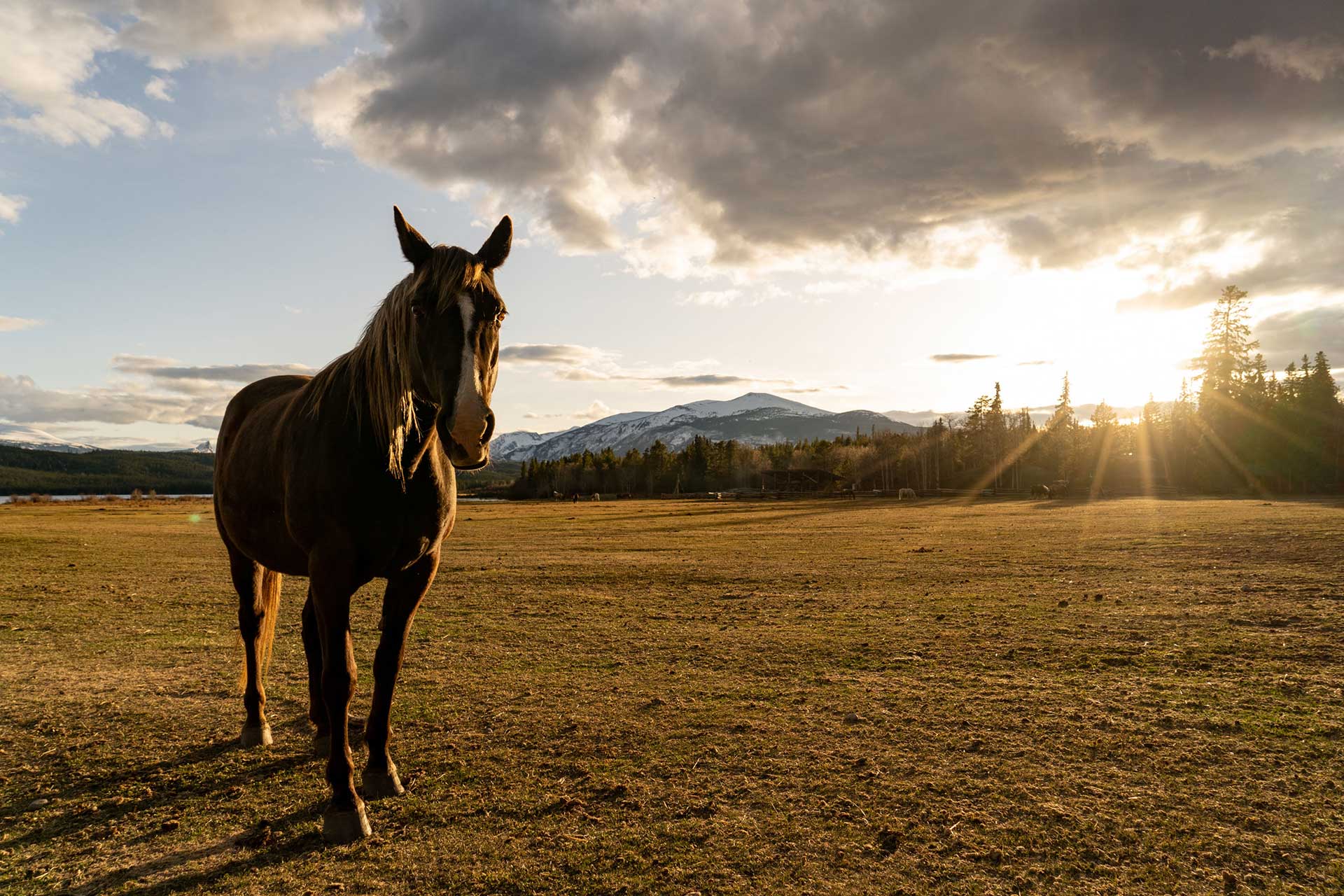
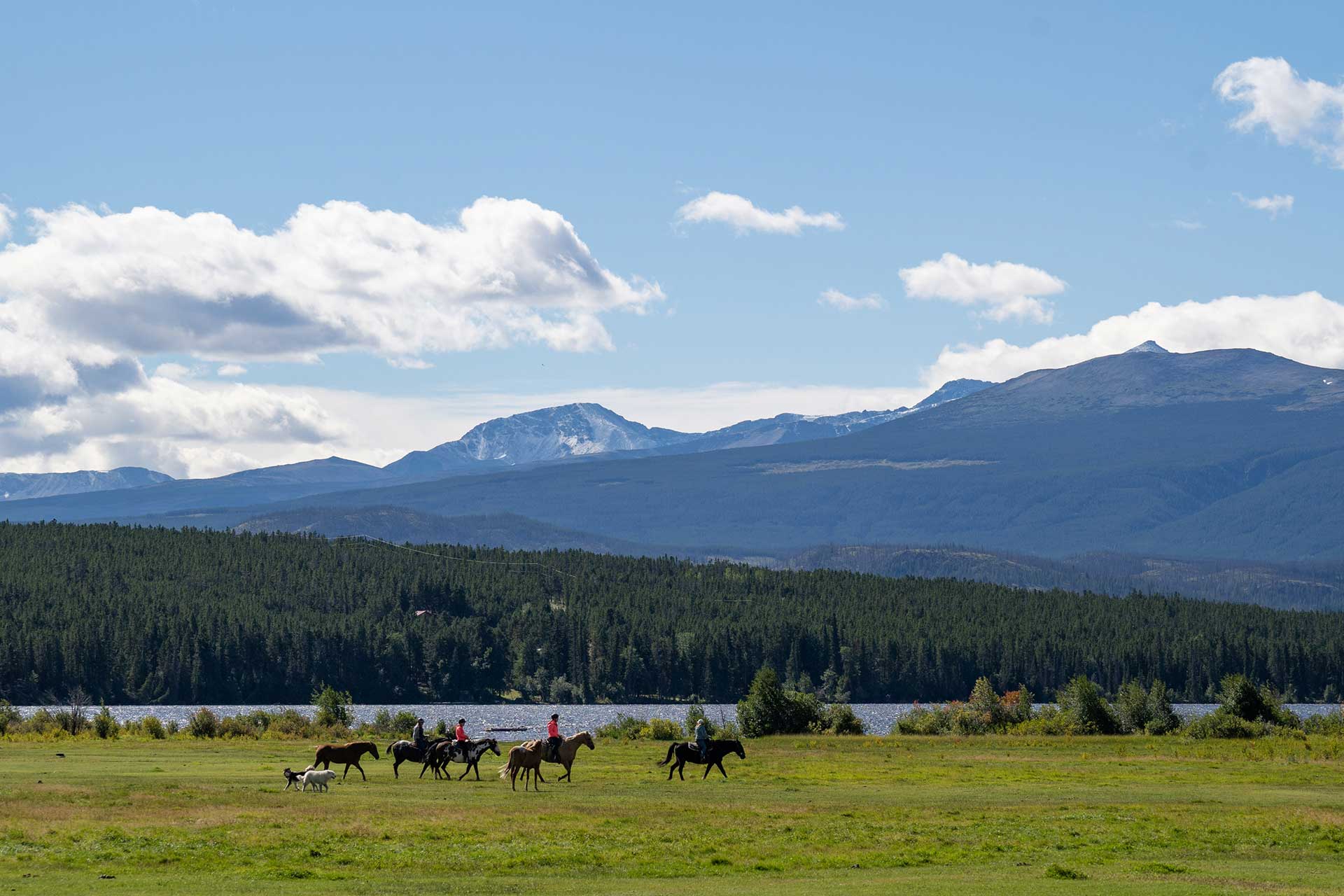
Wandering the fields to visit with the horses is a favourite activity here, or guests can venture through the nearby hiking trails or take a canoe or kayak out on the lake. There is no shortage of places to relax – from the reading nooks in the main lodge, to the sun-soaked deck and fire pit. Their well-appointed guest rooms are something of note – featuring large bed frames, tables and other features made by hand with wood milled on-site.
We begin each day with a horseback ride through the hills, on trails that weave through cedar and spruce trees to viewpoints over the lake. The horses are beautiful and well mannered, perfect for beginners or experienced riders alike. Falling into the rhythm of the horses movement, breathing in the fresh air with no other signs of humans around, it’s truly a meditative experience.
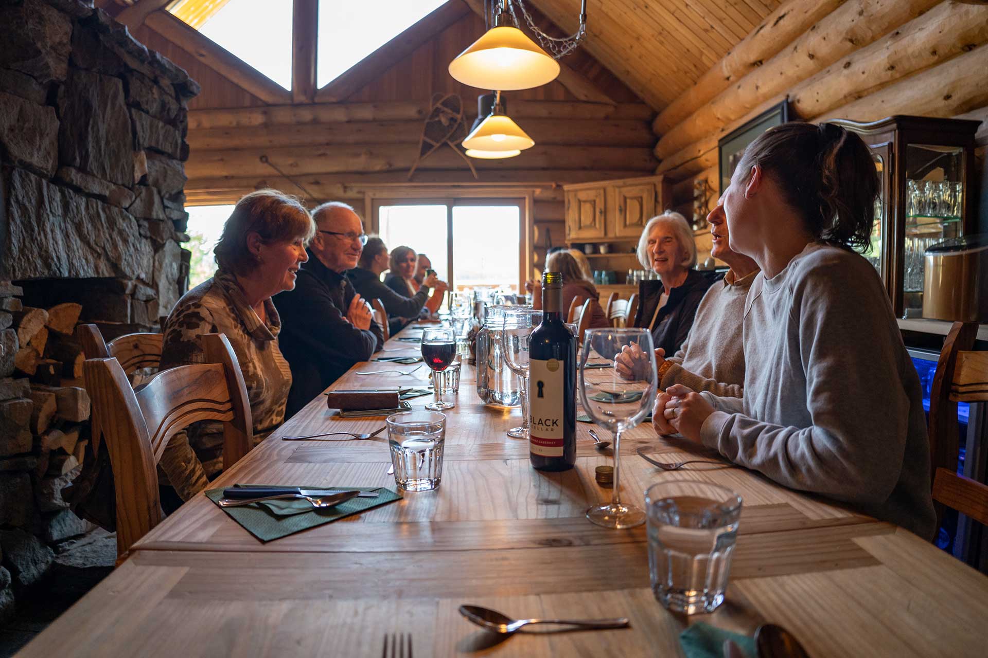
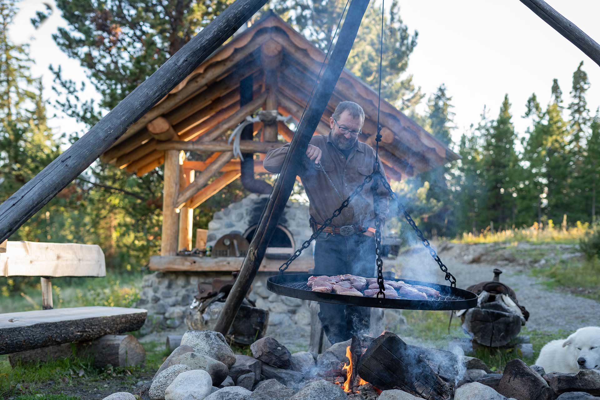
After a few days at the guest ranch, our travellers have fully embraced the concept of ‘slow travel’ in the Chilcotin. Long naps and reading in the sun lead to cocktails by the bonfire and a long-table dinner with staff and guests. This is often the highlight, the camaraderie with the group, sharing adventures from the ranch and other travels, coupled with incredible food served up by the in-house chef. We have the chance to chat with the owners and hear their story, and it becomes clear how much pride they hold for this retreat they’ve created.
The Coast Mountains & Hunlen Falls
From the ranch to the mountains – today’s adventure brings us via floatplane into the beautiful Coast Mountain Range. Setting off from Nimpo Lake, we cruise across the expansive plateau until the peaks come into view.
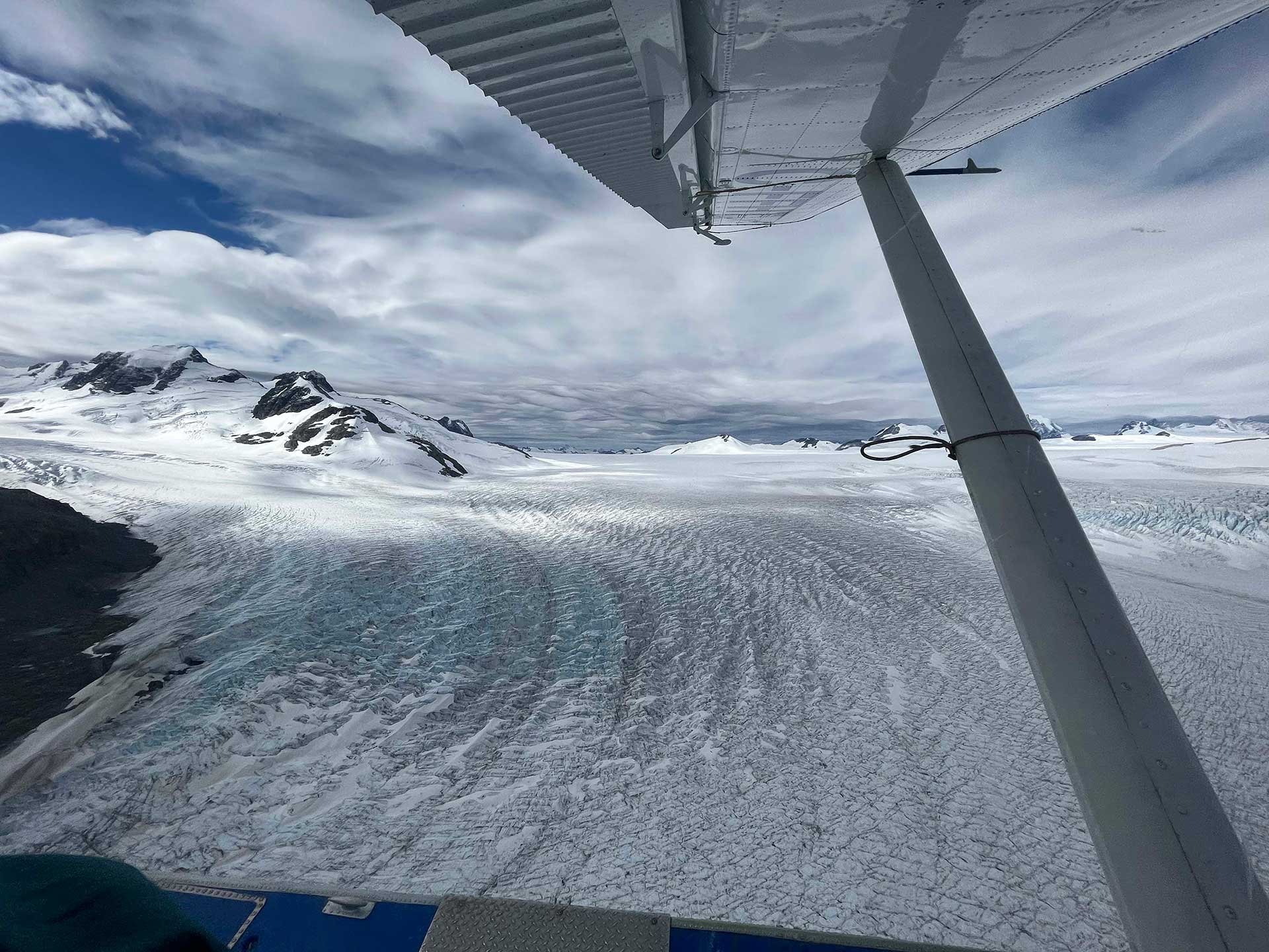
We catch a glimpse of Mt. Waddington, the highest peak in BC at just over 4000m, before ascending over the Monarch Icefield. As BC’s second largest ice formation, this impressive glacier field offers sweeping views of the mountains, deep canyons, and stunning aqua-blue lakes nestled in the ice and rocks.
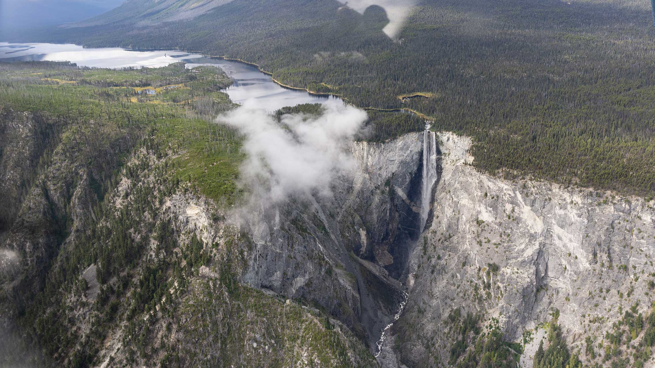
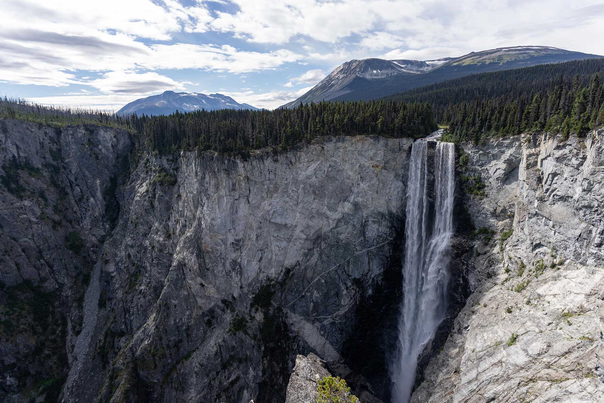
Our destination is Turner Lake, resting at 1100m in the rain-shadow of the Coast Mountains, which feeds the iconic Hunlen Falls. Our first view of this impressive waterfall is from the air, as our pilot circles past the lake and over the gorge below. Falling over 250m, this is Canada’s third highest single-drop waterfall.
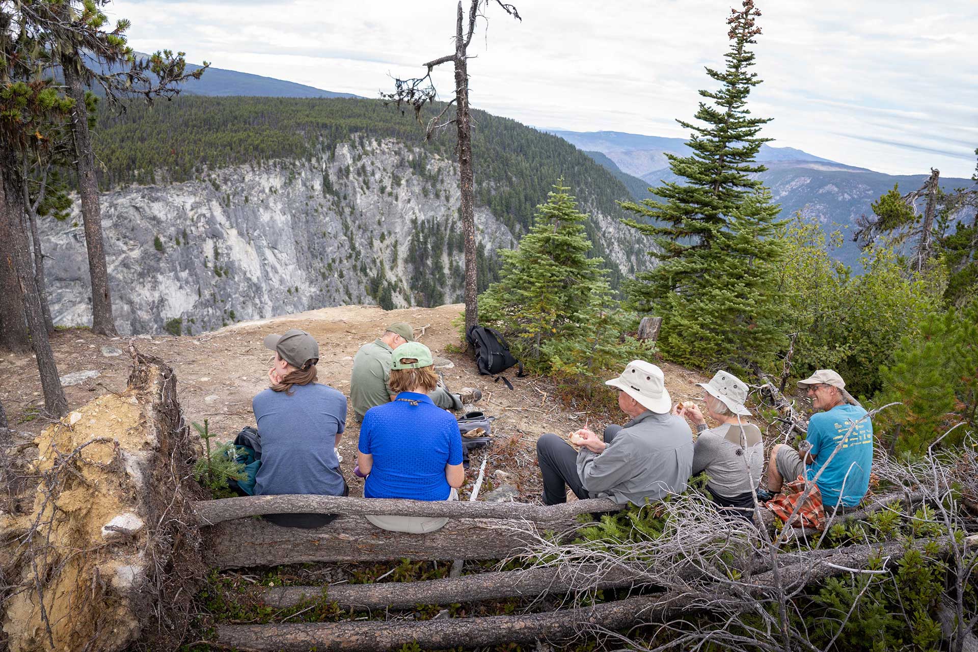
After landing on the lake, the park’s caretaker, George, greets us for a day of adventure. The park is quiet today – no signs of other hikers or canoeists, only of the birds in the distance. George leads the way, through the trails he created and cares for, as he shares stories of the wildlife, the sub-alpine environment, and the impacts from recent wildfires.
The trails lead to three different viewpoints on either side of the gorge, offering different yet equally stunning perspectives of Hunlen Falls and the surrounding topography. The lack of crowds, the unobscured views, and the ability to get (safely) close to the edge, is a luxury not often experienced at waterfalls of this magnitude.
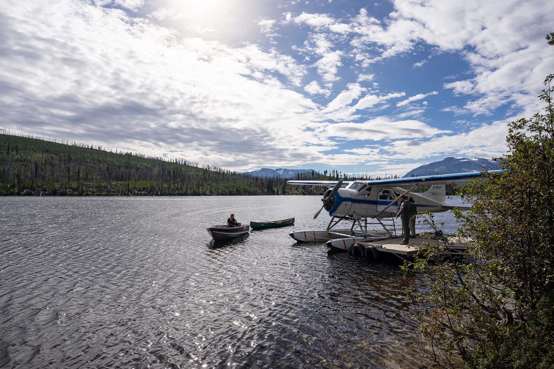
After a scenic lunch at the final lookout, we return to the lake to board our floatplane back home. One final delight awaits us on the ride – a fly-over of the Rainbow Range mountains, aptly named for its stunning colour palette of red, orange, yellow, and lavender sands. Formed from an 8-million year old volcano, the heavy mineral content in the volcanic lavas left us with this rainbow-like display.
In a region so remote and isolated, only accessible by floatplane or by intrepid hikers, we count ourselves lucky for the access we gained to such incredible sights, all within one day.
The Bella Coola Valley
The final leg of the Chilcotin journey brings us to the end of Highway 20 as we make the 1500m decent from the peak of the Chilcotin Plateau to the Bella Coola valley and Pacific Coast.
In the Bella Coola valley we are on the land of the Nuxalk First Nation. For centuries, First Nations and settlers alike have been drawn to this beautiful valley for the fertile land, abundant fish and other resources, and for the simple lifetime in rhythm with nature. There is a quaint small-town feel unlike anywhere else on our journey.
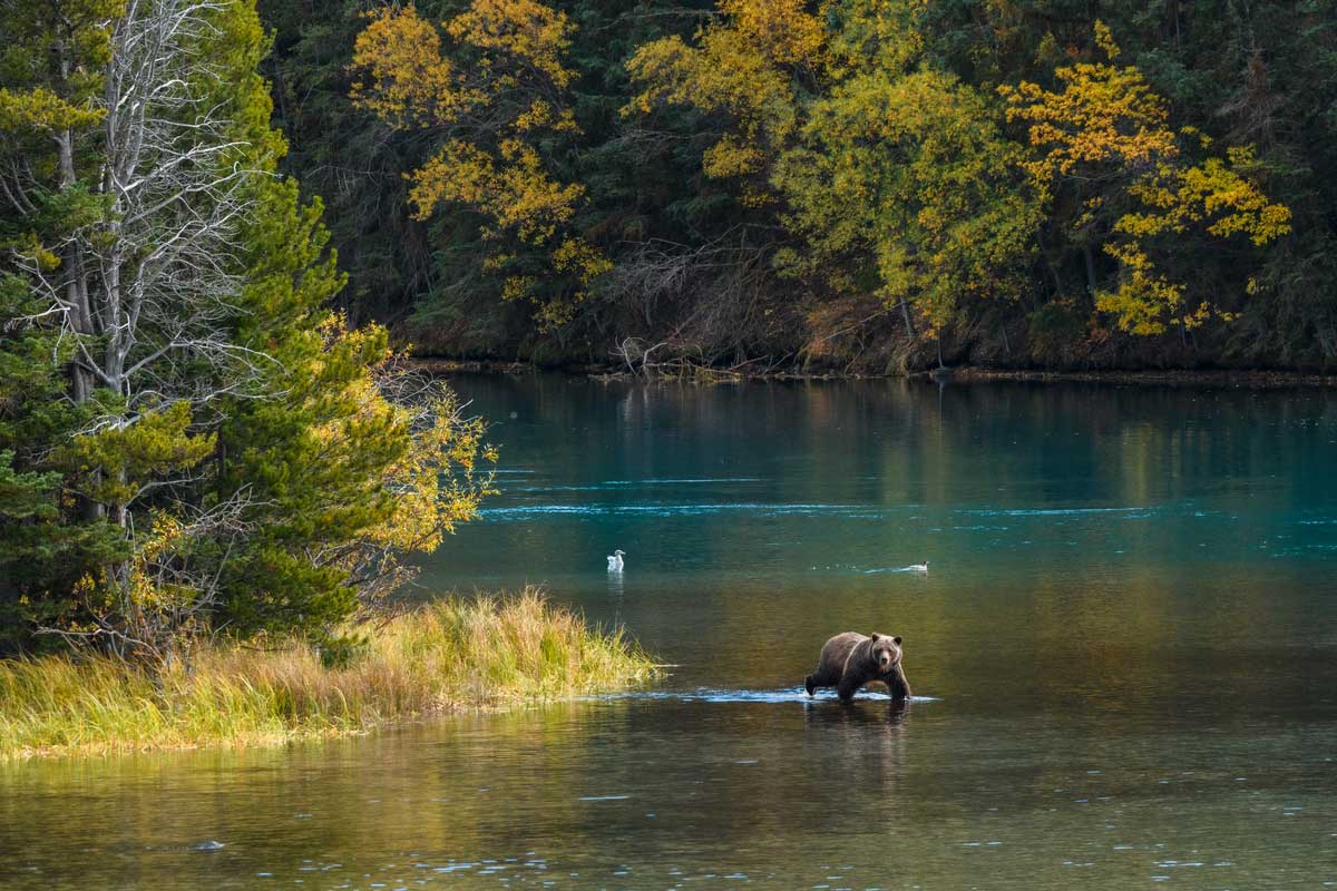
The first stop is Tweedsmuir Provincial Park – BC’s largest park spanning over 2 million acres – where the road carves through the middle of the park and provides access to this remote stretch of wilderness. Bella Coola is known for its grizzly bear population, and from mid-August to October, the bears can be seen on the banks of the rivers around Tweedsmuir feeding on spawning salmon.
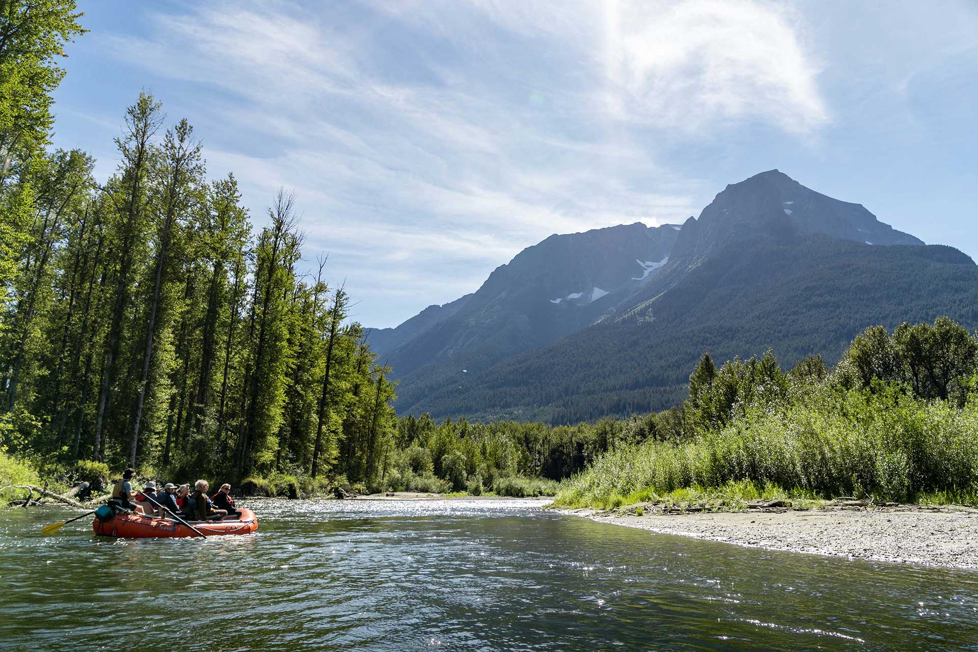
Our adventure today is onboard an expedition raft, where we are joined by a local guide and wildlife biologist for a float down the river. This is a unique opportunity to see the grizzlies, along with black bears, eagles, and other bird species, from river level without disturbing their habitat or behaviour.
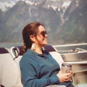
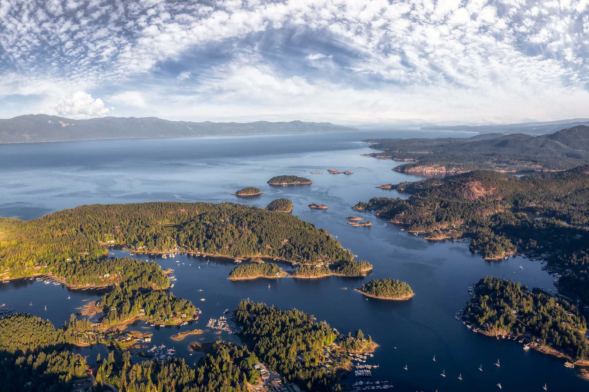
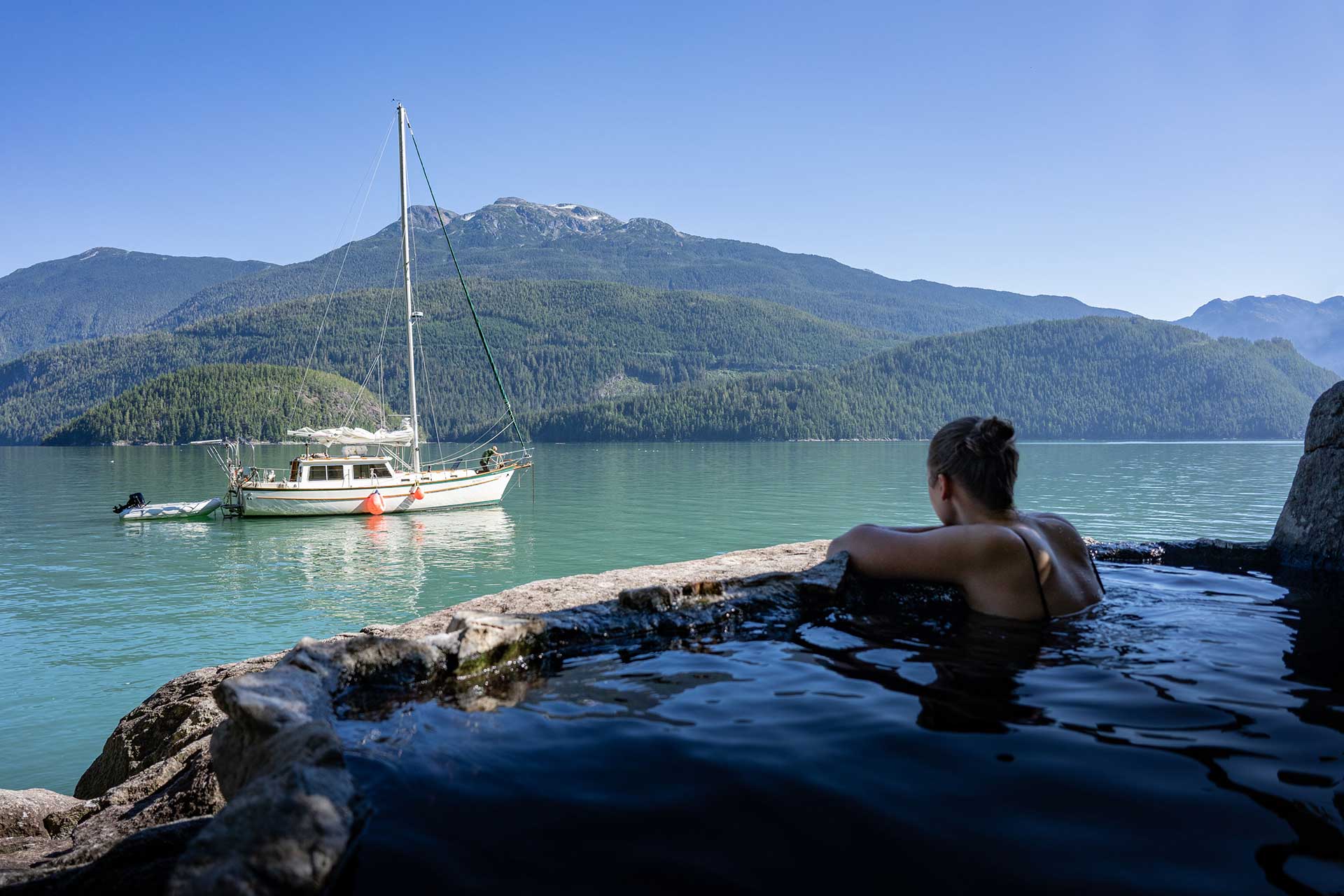
Moving from the rivers to the ocean, we spend our final day with a local sailor peacefully cruising the azure-coloured waters of the scenic inlets around Bella Coola.
We anchor by a natural hot spring that feeds a set of pools carved into the rocky shore, and spend the morning soaking in its soothing waters as our captain prepares a hearty lunch onboard.
As our adventure through the Chilcotin comes to a close, we reflect on all that we’ve seen – from the banks of the Fraser River to the desert of Farwell Canyon, the glacier fields and high elevation lakes to the salmon-filled rivers of the Bella Coola Valley.
The Chilcotin region holds so many treasures, some of which we can visit and others that will remain hidden in the vast, remote wilderness. Until next time…
JOIN US NEXT SUMMER
Journey to West Chilcotin
View the full itinerary and contact our team to reserve your spot.